Perhaps you recall from a post back in July (Welcome to Our Hen Houses) that we have two structures for housing our fowl. The guineas are housed in a free standing hen house, with indoor and outdoor areas. The chickens are housed in an enclosure within our equipment barn.  Locating the chickens within the equipment barn has proven to be a BIG mistake.   We like to release our chickens each morning and pen them back up at night, which means that there are times during the day that they congregate in the barn and on the equipment.  I’ll spare you any photographs, but you can imagine the mess they create on the equipment, which, I’m sure you’ll agree, is totally unacceptable. I suppose I should have anticipated this occurrence. I mean, it is called an equipment barn, is it not?
As it happens, our chicken flock has been reduced in number by predation, and there are only three remaining at this time. We have ordered chicks from a hatchery to augment our shrunken flock, and expect them to arrive in a few weeks. (if this cycle does NOT seem like deja vu to you, see the post To Free, or Not to Free (range your chickens, that is).  Prior to their arrival, we thought this would be a good time to relocate the chickens to housing located some distance away from the equipment barn. We have tried housing the chickens in a chicken tractor (see A Tractor for Chickens?) without much success, and have decided that another free standing chicken structure would be appropriate for our needs.
Having settled on the type of chicken housing we wanted, the next step was to choose between buying a prefab chicken structure or building one ourselves. When attending a HorseFest in Springfield last year, Retta brought home a catalog from an Amish owned company in Seymour, Missouri that produces a variety of livestock shelters. Within the catalog were several structures that could possibly suit our needs, so we thought we would take a ride to Seymour and look them over so that we could make an informed build-buy decision. Only one thing stood in the way of our plan to drive to Seymour – Bull Shoals Lake.
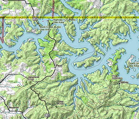
This topographic map depicts a portion of Bull Shoals Lake. It is a lake about 40-50 miles long created by the (some would say the damn) damming of the White River, which formed a lake with a multitude of fingers and a shoreline exceeding 1000 miles! You can see a yellow boundary line in the map, which represents the Missouri-Arkansas border.
We reside on the south side of Bull Shoals Lake, while Seymour, Missouri lies well north of the lake. Driving all the way around Bull Shoals Lake is a long detour for someone heading due north, and there are no bridges spanning the lake at any point. So what’s a person to do?
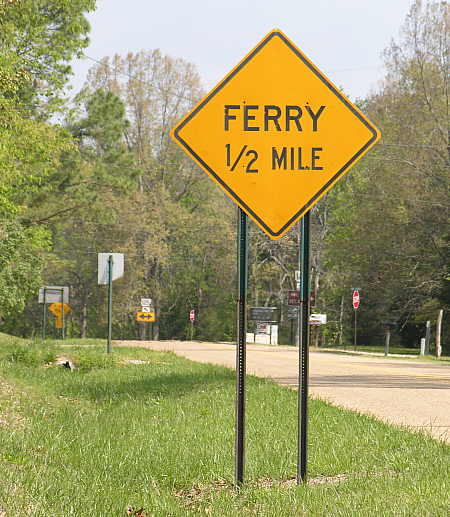
That’s right – hop on board a ferry to be shuttled across the lake! The Ozarks is an area that is blessed with an abundance of surface water in the form of creeks, streams and rivers. In earlier times, there was a large number of private and public ferries in operation that transported people, wagons and livestock across the many waterways that occur in this region. One by one, the ferries halted operation as bridges were built to span the rivers of the area. In Arkansas, by 1968 the hundreds of ferries that had served the state were reduced in number to 17. By 1986, there were only 4 ferries remaining in operation, and today, there is only 1 ferry that continues to serve the public in Arkansas – the Peel Ferry. And so our journey to Seymour, Missouri would take us on a minor, but quaint adventure across Bull Shoals Lake on the last surviving Arkansas ferry.
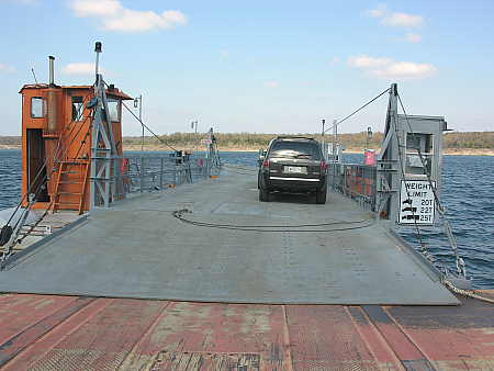
I have had the good fortune to travel around the Puget Sound and Strait of Juan de Fuca in the Pacific Northwest on many occasions. Ferry travel is common in that area, and I have ridden those ferries a number of times. Big ferries, with multiple automobile decks, passenger lounges, food and beverage service, and some (for longer journeys) with sleeping accommodations. The Peel Ferry has none of these amenities, as is obvious from the following photograph-
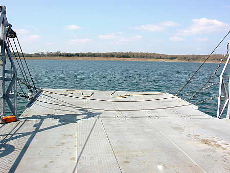
The Peel Ferry is about as simple as a ferry can get. It is no more than a barge with ramps on each end, powered by a small tug lashed to the side of the auto barge. It will only hold about six vehicles, and has no passenger amenities at all. Simply a way across the lake. But the price is right – the ferry is free for all to use.
Here is a photograph of the ferry leaving the the dock on the south side of Bull Shoals Lake, as it begins it’s short journey to the opposite side of the lake.
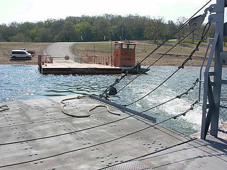
Unlike the ferries of the Pacific Northwest, which ply ocean like waters, this ferry only traverses a short section of placid lake water. The loading ramps do not even need to be elevated for the trip across the lake.
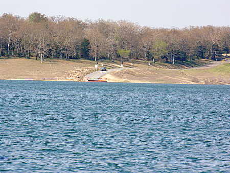
Eventually, the ferry approaches the dock on the opposite shore of the lake. Notice the massive lineup of cars awaiting the ferry at it’s terminus? The question might arise, “why does this ferry continue to run, especially at no charge, when all the others have discontinued operation”? The answer lies in a close examination of the topographic map that appears at the beginning of this post. You will notice that below the Missouri border, but north of the lake the is a large chunk of land protruding down into the lake area. This land area is too small to form it’s own political jurisdiction, but large enough to contain roads, and probably several hundred residents, all of whom need the services that are typically provided by a county government.  Lacking a costly bridge, the county would be faced with the daunting prospect of having to provide services to this portion of the county by routing vehicles and road equipment all the way around the lake, into Missouri, and then back down into Arkansas again. Instead, the Arkansas Department of Highways and Transportation has opted to maintain the services of the Peel Ferry, primarily for the benefit of the county, but available for all motorists to use.
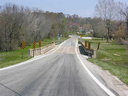
After leaving the ferry, the small highway that services the area winds through the beautiful landscape of the Ozarks. The picture above shows one of the two one-lane bridges that are located shortly beyond the north terminus of the ferry. All-in-all, the Peel Ferry adds a quaint charm to what would otherwise be merely a bucolic and picturesque drive in the countryside. If you are ever in the area, make it a point to be one of the few people who gets the opportunity to ride the last remaining ferry in Arkansas.



I’ve crossed the Mississippi River above St. Louis a number of times on a ferry. I suppose if I thought about it, I might be frightened. You really can’t go very many places in Seattle without using a ferry sometime.
Hal, you were all over my old stomping grounds (Seymour/Mansfield area). My first job was the grocery store in Seymour.
I never knew about this ferry. Thanks for sharing!
you’ll be driving right past the pile of omelays. i mean within a 1/8 mile!!!
I love ferrys. There’s a neat one in Mayport,Florida and at least one near Welaka.
Pingback: Ranch Ramblins » Blog Archive » I’m In a Fowl Mood Today